Showing posts with label ATV. Show all posts

Monday, August 05, 2019

Quads and Camping on North Vancouver Island

Our truck and double quad trailer.
Wayne and I like to take our quads on barge trips around Powell Lake and truck and trailer trips to land based destinations. We took our Tucson SUV to North Vancouver Island to plan a future ride.

Read more about that road trip at my Margy Meanders blog.

The Campbell River ATV Club has been instrumental in developing off-road routes using logging roads throughout North Vancouver Island. They have also worked with RCMP precincts to allow access to lodging, food and gas. Click here for more information.

There are map resources for Forest Service and logging roads.

A section of the North Island route map from the Campbell River ATV Club.

Here are some of the campsites we discovered on our trip.

Picture from Rec Sites and Trails BC.
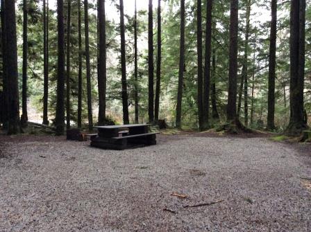
Elk Creek Recreation Site: Seasonal campground south of Highway 19 near the the Sayward turnoff. Seven site campground with good availability but no direct access to logging or forest service roads but could make a good homebase then transport quads to off-road areas.

Montague Creek campground.
Montague Creek: Two small primitive sites along the river just past Sayward via Eve Main. Direct access to logging roads but too tight for us.

Upper Klaklakama Lake Campground: Small site at the top end of the lake. Too tight for us but direct access to logging roads. Another large campground farther down the lake.

Woss Lake Recreation Site campground.
Woss Lake Recreation Site: Twenty-four sites with good availability on upper Woss Lake with easy dirt road access via West Woss Road. Sites large enough for our truck and trailer and direct access to logging roads. Logging railway historical display in town.

Georgie with empty lakefront site.
Georgie Lake Recreation Site: A nine site lakeside campground reached via the Holberg Road out of Port Hardy and Georgie Lake Forest Service Road. Sites are large enough for us and there is good access to an extensive logging road network for riding. However, it is too far on rough roads for us, but we did find a travel trailer there.


Link River campground on Alice Lake.
Link River Regional Park: A 22 site campground on Alice Lake near Port Alice. This is the one for us. Good access via SE Main and there was good availability even on a holiday weekend. It has a host and reservations in summer and first come, first serve the rest of the year. Lots of logging road access in all directions.

We could stay here many times and still not explore everything. Plus there is fuel and shopping in nearby Port Alice for extended stays. Don't know when, but we will be returning with our truck, trailer and quads for a new kind of adventure up North Vancouver Island's mains.


Want to read more about our quad adventures? Three of Wayne's Coastal BC Stories books focus on backcountry adventures including Up the Main, Farther Up the Main and Powell Lake by Barge and Quad.

All three are available in print and e-book formats at Amazon and most online booksellers. In Powell River they are available at Coles in the Town Centre Mall. -- Margy

Tuesday, December 11, 2018

Riding the Duck Lake Forest Service Road Region

Westlake Woodlands logging map.
We went on a fall quad ride to explore the region you can access from the Duck Lake Forest Service Road. We invited our good friends Dave and Marg to join us. First, we enjoy riding with them. Second, Dave knows the trails around Powell River much better than we do.

We went on a Sunday when loggers know to look out for the public on our backroads.

We drove south of town to the junction of Highway 101 and Duck Lake Forest Service Road, a well maintained backcountry mainline.

Parking out of the way on a side sput.
A short ways up the dirt road are spots to park.

The area in which we rode was part of the Westlake Woodlands managed by locals Doug and Ron Fuller. They offer a free online map that can be used with Avenza GPS map app to track your route.

Dave, Marg and their dog Crystal.
Unfortunately, we didn't take ours since Dave was leading. It would have been a great reference for future rides.

While I can't share the exact route, we left Duck Lake Main to follow several old logging roads through the lush second growth forest.

The Blue Trail Connector back to Duck Lake Main.

Many old roads and trails are maintained by local ATV, biking, horseback riding and hiking organizations. Being close to town, they are well used and enjoyed by many. Yet, on our ride we didn't see any other quad riders and only one hiking group and a man walking his dog.

East Lake

We stopped at East Lake for a picnic. There are log benches, a fire ring and a dock that would enjoyable especially in summer.

Picnic stop.

We continued through the area with a stop at West (Hammil) Lake. The weather was already changing from mostly sunny to mostly cloudy.

Clouds hovering over West Lake.

We'll go back on our own to explore the Duck Lake area while our quads are stored in town.

A rare picture of us together thanks to Dave.

Thanks Dave and Marg for sharing your trail knowledge and friendship with us. If you come to visit Powell River, I highly recommend using Duck Lake Forest Service Road as a starting place to explore the backcountry. -- Margy

Wednesday, March 28, 2018

Take Your Quads on Vacation

Last summer we put our quads on a trailer and took them on vacation with us to Vancouver Island. Our destination was Stella Lake near Campbell River. Here's the article that was just published in the Spring 2018 Riderswest Magazine and on their website.

Take your quads on vacation.

My husband and I have ridden ATVs in our home region of Powell River, B.C., for 15 years. In 2017, we explored the Campbell River region on Vancouver Island.

Old logging road to Bear River.

I follow the Campbell River ATV Club (CRATV) on Facebook and the CRATV Forum and know they are active in trail maintenance. They’re also instrumental in developing long-distance ATV routes (Riderswest article) and have secured riding permission in some towns to access fuel, restaurants and overnight accommodations. CRATV uses the Pye Mountain Recreation Site, which they built as a base for club activities. It can be accessed via Highway 19 north of Campbell River and the Elk Bay Forest Service Road (FSR).

Stella Lake Beach campsite.

We wanted to camp near water, so we selected Stella Lake based on a recommendation from friends in the Powell River ATV Club. There are two ways to get there, either by Elk Bay or Rock Bay forest service roads. We chose the Rock Bay to Stella Lake FSR because, with our double quad trailer, we wanted to avoid the steep hill and tight turn on the Elk Bay route. On the way we stopped at the Roberts Lake Resort café for one of their famous cinnamon rolls.

Blue sky and water at Stella Lake from Elk Bay FSR.

We travelled in June on a Thursday. Stella Beach’s campsites were mostly open and we chose one with lake access. We offloaded our quads at the entrance, then parked the trailer in the ample site. There are pit toilets, picnic tables and fire rings, but campers should bring drinking water. Even in June, the campground filled over the weekend, but there are other camping spots in the area.

Excellent signage including experience level.

From our campsite, we rode forest service roads and trails developed by the Campbell River ATV Club. There’s excellent signage that includes experience level symbols. As an intermediate rider, that was very helpful. We also purchased Backroad Maps software for our Garmin GPS to make us more confident about riding in a new location.

Overlooking Johnstone Strait from Rock Bay FSR.

Some of the most memorable rides were to Elk Bay on Johnstone Strait, visiting the Pye Mountain Rec Site, and going to neighbouring Pye and McCreight lakes. My favourite ride was along an old logging road that branched off Bear Bight Road and wound through second growth to the Bear River (a.k.a. Amos de Cosmos Creek). Here, we enjoyed a picnic lunch in warm sunshine surrounded by a meadow of sweet gale.

Sunny day for a picnic at Bear River.

Where will you be going this summer? Check out the Powell River Quad Rides blog and Powell River ATV Riders’ Facebook group and bring your quad on vacation to the northern Sunshine Coast.

Check out Coastal BC Stories about quad riding including Farther Up the Main by Wayne Lutz. -- Margy

Wednesday, March 21, 2018

Spring Quad Ride Up Chippewa Main

Offloading at the Chippewa Bay barge ramp.
I've shared about rides up Chippewa Main here and on Powell River Quad Rides several times. That's because it's an easy place for us to access with our barge and because it gives us choices in directions to ride.

On this spring ride we took our quads to the Chippewa Bay barge ramp to offload. This is our usual starting point. Because there's current logging activity, the barge ramp is well maintained.

Ready to ride,

We chose a Saturday for our ride because the logging company expects more private use of their service roads, and because weekend activity is usually less. On our ride, the only work being conducted was vehicle maintenance. The roads and trails were all ours.

An old section of logging road heading up towards Heather Main.

This trip was to see if we could get through the snow to Heather Main that connects Powell Lake with Theodosia Inlet to the northwest, but we were blocked by pockets of deep slushy snow near our destination.

Using the slushy snow to make a slushy drink. Take that deep snow.

Come along on the ride up to Heather Main in this YouTube video.


Since our ride some of our friends made it through. The warm late spring weather is quickly melting snow in the high country and reopening many of our favourite trails.

Blue skies over Powell Lake on the way to Hole in the Wall.

Do you have any quad trails in your area that you would like to suggest? We are always looking for new places to ride and explore in British Columbia including Vancouver Island.

You can read more about our Powell Lake quad rides in Beyond the Main and Powell Lake by Barge and Quad. Both are available online in print and ebook formats. -- Margy

Tuesday, February 20, 2018

Winter Quad Ride on Goat Island

We waited a long time for a sunny weekend to go quad riding. Logging roads in working forests are available for public recreation after 6:00 pm or on weekends and holidays.

On a sunny Saturday we headed for a favourite destination, Goat Island.


We took our new Garmin VIRB Ultra30 with us. Here are three short videos from the film taken on that trip.

We left Hole in the Wall in our barge with the quads loaded out front. We headed north in calm water to Western Forest Products' Goat Island (Clover) Dock. We used their barge ramp to off-load and later on-load our quads.


We used Frog Pond Main to get up to Spire Main on the southwest side of Goat Island. On the way we encountered deep snow on the road, which surprised both of us.


After turning around we went on a spur in search of two large trees we can see on the ridge of Goat Island from our float cabin home in Hole in the Wall. We didn't succeed, but had a great ride on an older deactivated road.


Thanks for coming along on our ride. We had a very enjoyable day and learned a lot about our new camera. And later I also learned a lot about using the new version of iMovie to create my videos.

Do you create videos about your activities and adventures? What kinds of cameras and software do you use? -- Margy

Tuesday, October 17, 2017

Fall Quad Ride to Chippewa Bay

Unloading the quads at Chippewa Bay.
Summer rides are fun because the weather is usually sunny and warm. The down side is dusty roads and trails. Fall rides are just about perfect, the weather is pleasantly cool and the roads have received enough rain to tamp down the dust.

We loaded up the barge with what we would need for a day quad ride to Chippewa Bay. The quads stay on the barge all year long, but in the rainy season we take everything out of our cargo boxes to keep it from getting damp and possible damage. Plus it's always good to take along a chain saw just in case a fallen tree blocks your way.

Riding well used Museum Main to find the new logging roads.

We wanted to ride over in the Chippewa Bay area on Powell Lake because Western Forest Products has been building new roads into future cut blocks. We like riding through the trees before logging begins. We've been able to experience such rides in the Eldred River Valley, at Chippewa South, at Pickles Point and now in Chippewa Bay.

Large fir trees along Chippewa Main.

After the roads are completed, the logging company waits for several months for the newly compacted dirt and rock to settle before heavy logging trucks and equipment begin their work.

Wayne coming down a new section of road.

We missed seeing all of the large trees cut down to make way for the new road beds, but a few were still resting at the side of the road.

Wayne next to two sections of a huge fir tree.

This fir tree was over a hundred years old based on the tightly spaced rings. Just think of all the lumber that could come out of each section and how many new homes it could help to build.

Tightly spaced rings make this tree well over a hundred years old.

There are sections of road that are too steep for me to feel comfortable. Wayne rides ahead while I get off my bike to explore and take pictures. I found a Western Toad hiding in a hole. Right now her looks pretty secure, but I'm not so sure it will stay that way when huge trucks start rolling with their massive log loads.

A Western Toad in his hidey at the edge of the new logging road.

And there were still a few flowers to be seen.

Pearly Everlasting doing what it does best, lasting forever.

A bee enjoying a last few sips from a Butterfly Bush.

We stopped by the log skid and could see a boom of logs already boomed together. These came from road clearing. It's good to see nothing being wasted.

Looking down the skid to the first boom of logs.

Wayne checking his iPad GPS to see our track for the day.

Using the iPad GPS for road identification and tracking.

Western Products Products has online geo-referenced maps that can be used with handheld devices. Click here to find WFP map and other road building, logging and hauling information. Click here to find information about the Avenza map app. The basic app and WFP maps are both free.

Have you been riding this fall? What are some of your favourite destinations?

Want to read more about how we use a barge to take our quads to ride the logging roads surrounding Powell Lake?

Powell Lake by Barge and Quad is available in both print and e-book formats at Amazon.com and Amazon.ca. It's also available at other online booksellers and Coles bookstore in Powell River. -- Margy

Wednesday, August 02, 2017

Old Timer


Do you like old rusty things? -- Margy

Tuesday, July 25, 2017

Goat Lake Barge and Quad Ride

One of our favourite spots to take the barge and quads is the head of Goat Lake. Because of a large construction project last year at a friend's cabin we didn't get there. Last week was our best chance while the lake level was still high enough.

Barge and quad routes for Goat Lake.

We offloaded our quads at the barge ramp and out of the way for two days of camping and riding on the logging roads and trails.


Since there isn't a dock at this location, we used our empty barge for both our tent platform, lounging spot and kitchen area.


The Eldred River flows into Goat Lake. Wayne took some time to do some catch and release fishing in the rushing water.


We stopped at the Eldred Valley rock climbing location. After walking down to the river we met a climber and he pointed out friends high on the cliffs. Here's one of the steel cable lines they use to cross the river to reach the high cliffs on the other side.


This trip we tried a new road, B Branch that heads up to Emma Lake. It was a nice shady overgrown logging road in good condition for a quad. We met a pickup coming out. He was having more difficulty, especially crossing a steep sided stream.


To get to and from Goat Lake you pass through meandering Goat River. At low water it is shallow and difficult to navigate. Where Goat River empties into Powell Lake there's a stump forest where logging occurred prior to the installation of the dam in the early 1900s. Follow the markings and floating buoys to stay clear. This passage is also part of the Powell River Canoe Route.


Wayne and I share driving duties in the barge. For such a large craft it is easy to drive and maneuver. It is also very stable even in rough water.

It's the best purchase we ever discovered on Craigslist. -- Margy